Hydrographic Survey
Call Paisano Dimensional Control for Hydrographic Survey
austin@paisanodc.com
Paisano Dimensional Control offers dimensional control (DimCon) surveys for commissioning hydrographic survey vessels of all kinds. We provide offset/lever arm surveys and calibrations for Gyro, IMU and DGPS systems against ground points using grid coordinates.
As standards in marine surveying get tighter, precision is paramount. Hydrographic survey vessels, responsible for mapping the seafloor, measuring water depths, and gathering data on submerged features, require precise tuning and alignment to ensure that their operations are accurate and reliable. Dimensional control surveys play a crucial role in establishing and maintaining the accuracy of data these vessels produce. These surveys ensure that the vessels’ physical structures, instruments, and positioning systems are aligned and calibrated to meet the rigorous standards of the hydrographic survey industry.
When commissioning of a new hydrographic survey vessels or changing/installing additional sensors it is vital to verify the exact position of each of these instruments relative to the vessel’s coordinate system based on the hull. Centerline of the vessel is established in dry dock from the keel or quayside from the wheelhouse or mast and the center stern. The Z plane is measured with points around the deck. All offsets are then relative to this coordinate system. This will ensure that the survey data collected will be as precise as possible and it greatly reduces the time necessary to complete GAMS and patch testing. DimCon also makes alongside nav checks and sea trials necessary to be completed much quicker to gain vessel acceptance from the client. This helps our customers bottom line by reducing overhead days before they can go on contract.
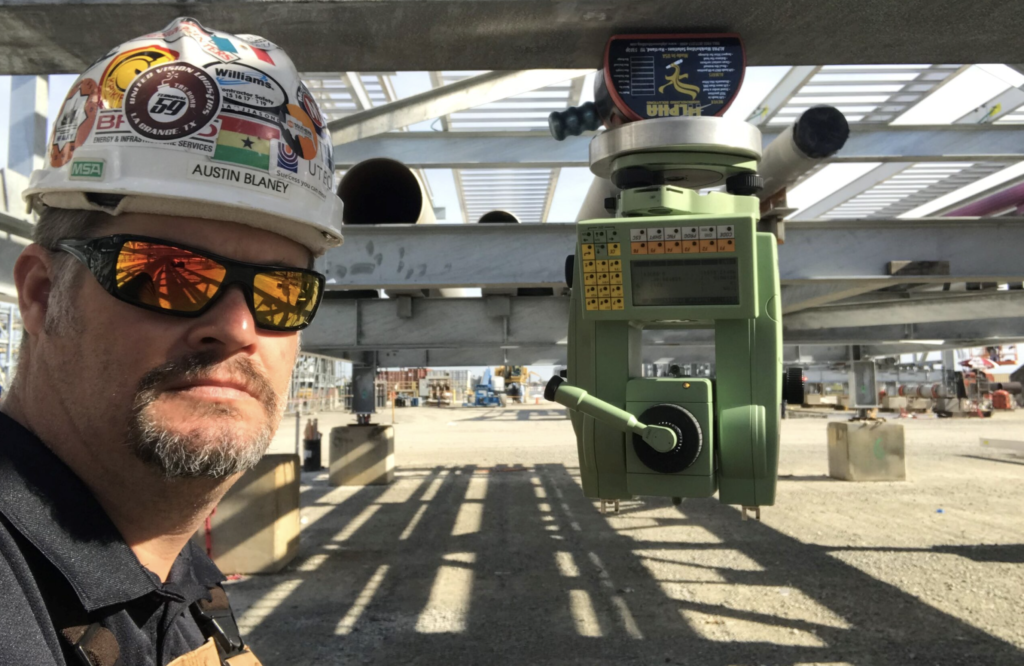
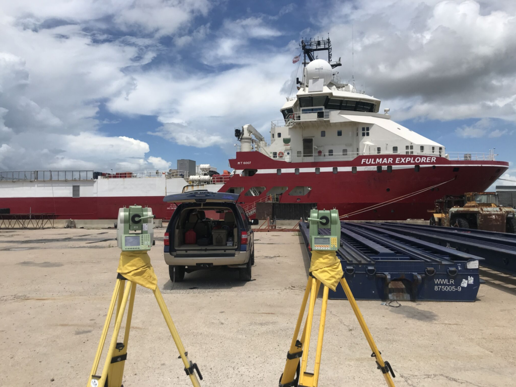
Using high precision 1 arc second Leica total stations with Spatial Analyzer metrology software, it allows us to work on the vessel quayside pitching, rolling and unleveled and still provide 1mm accurate feature offsets/lever arms in the same coordinate system. We use 4 – 6 GPS static control points on the dock to establish a network of grid coordinates that we use to carry out Gyro and DGPS verifications. Heading, Pitch and Roll verifications are completed with two total stations taking simultaneous shots synchronized to GPS UTC time so data can be compared to time stamps from vessel logs. In most instances we are able to provide all C-O corrections before we leave the vessel. Our goal is for the boat to go to work as soon as possible after we complete our scope of work for the DimCon vessel calibration.
Our experience ranges from drill ships all the way down to side scan tow fish. We can assist with all size boats, ROVs, AUVs, USVs, etc., whether quayside or in dry dock.
Paisano Dimensional Control uses precision survey equipment and metrology software to capture and interrogate data. Survey reports are provided to client and crane inspectors for review and we can assist with making adjustments and repairs as needed. We can also provide as-built surveys to record successful adjustments and provide a baseline for future survey reference.
Contact us to discuss details about your Hydrographic Survey needs.
austin@paisanodc.com
Hydrographic Survey Services by Paisano Dimensional Control
At Paisano Dimensional Control, we don’t just offer a hydrographic survey—we deliver actionable, high-precision underwater data that engineers, contractors, and project managers can stake their decisions on. Our team brings decades of marine and geospatial expertise to every job, combining advanced bathymetric technology, survey-grade positioning, and data modeling to map the unseen with confidence.
If you’re responsible for marine construction, dredging oversight, infrastructure installation, or environmental monitoring, you already know the difference between generic data and dimensional control-grade results. That’s where we come in. Our hydrographic survey services are designed to reduce risk, drive accuracy, and support compliance—all while integrating seamlessly with your existing project workflows.this system in place, the collected data is as accurate as possible, enabling quicker completion of essential tests like GAMS and patch testing.
Why a Hydrographic Survey Is Essential to Your Project’s Success
A hydrographic survey is far more than plotting water depths. It’s the foundational dataset for any project operating in, under, or near water. You need to know exactly what lies below the surface—whether it’s bedrock, silt, a submerged utility line, or an unexpected obstruction.
At Paisano Dimensional Control, we treat every hydrographic survey as a critical decision-making tool. From pre-construction due diligence to post-dredge verification and infrastructure inspection, we provide the real-time underwater intelligence that shapes safe, efficient operations.
Our surveys support:
- Port and harbor maintenance
- Offshore wind and energy site assessments
- Dredge quantity validation
- Subsea pipeline routing and installation
- Marine cable laying
- Coastal erosion and scour analysis
- Environmental and habitat mapping
- Underwater infrastructure inspections
- FEMA floodplain modeling and permitting
We don’t just hand over data. We provide insight.
High-Resolution Bathymetric Data with Full Geospatial Integrity
Precision matters. That’s why every hydrographic survey we perform leverages the most advanced bathymetric and positioning systems in the industry. Depending on the project’s technical requirements, we deploy:
- Multibeam Echo Sounders (MBES) for dense swath coverage and high-resolution 3D terrain modeling
- Single Beam Echo Sounders (SBES) for reconnaissance or long-line surveys with reliable point accuracy
- Side Scan Sonar (SSS) for seafloor imaging and hazard detection
- Sub-bottom Profilers (SBP) to reveal sediment layers, buried structures, and stratigraphy
All data is collected with RTK-GNSS positioning and vessel motion compensation to eliminate distortion from heave, pitch, roll, or yaw. Our deliverables include gridded bathymetric surfaces, point clouds, TIN models, vector contours, and CAD/GIS-ready formats—customized to your platform and software needs.
When we say dimensional control, we mean it.
Full Lifecycle Support: From Pre-Construction to As-Built
One of the most overlooked advantages of a professional hydrographic survey is how it supports the entire lifecycle of a project—not just one phase.
- Feasibility & Planning: We provide accurate terrain models to evaluate constructability, utility conflicts, and permit requirements.
- Construction Monitoring: We track dredging progress, trench backfilling, pipeline placement, and scour protection efforts.
- Post-Construction Verification: We perform as-built surveys and change detection analysis to confirm installation accuracy and regulatory compliance.
Whether your goal is a precise dredge prism, a verified utility crossing, or just peace of mind before mobilizing a $10M barge crew, we give you the data that keeps projects on track and under control.
Trust Paisano Dimensional Control for Your DimCon Survey Needs
When it comes to DimCon surveys, Paisano Dimensional Control is the name to trust. Our commitment to precision, efficiency, and client satisfaction sets us apart as the go-to provider for dimensional control services. Whether you’re commissioning a new hydrographic survey vessel or upgrading existing equipment, Paisano has the expertise to get the job done right.
Don’t settle for anything less than the best. Contact Paisano Dimensional Control today to learn more about our services and how we can help your vessel achieve peak performance.
Our Hydrographic Survey Tools & Techniques
There’s no such thing as a one-size-fits-all survey. Our team tailors the methodology, vessel platform, and sensor configuration based on project parameters like depth range, tidal influence, substrate type, and horizontal/vertical accuracy requirements.
Our field setups include:
- Survey-grade GNSS/RTK base stations and receivers
- Motion Reference Units (MRUs) and Inertial Navigation Systems (INS) for 6-DOF vessel compensation
- Tide gauges or water level monitoring systems where local tidal datums or orthometric elevations are needed
- Real-time onboard QA/QC workflows to validate coverage density, ping rates, and data consistency
- AutoCAD Civil3D, ArcGIS Pro, and QPS Qimera/Caris for post-processing and deliverable generation
We also offer bathy-topo integration using UAV or terrestrial LiDAR when needed, providing a seamless land-to-water transition for shoreline and infrastructure modeling.
Regulatory Compliance and Permitting Support
Our hydrographic surveys are built to meet or exceed regulatory standards from agencies like:
- USACE (U.S. Army Corps of Engineers)
- NOAA Office of Coast Survey
- BOEM (Bureau of Ocean Energy Management)
- BSEE (Bureau of Safety and Environmental Enforcement)
- FEMA (Federal Emergency Management Agency)
- Various DOTs, port authorities, and municipal water boards
Whether you’re submitting data as part of a permit, inspection, or construction submittal package, we ensure your survey output is defensible, traceable, and presentation-ready. We provide all associated metadata, horizontal/vertical control logs, and coordinate system transformations (WGS84, NAD83, NAVD88, MLLW, IGLD85, etc.).
If it needs to be certified, timestamped, or mapped to a specific datum—we’ve got it covered.
Real-World Applications That Drive Real Results
We’ve performed hydrographic surveys across a range of challenging environments—from sediment-choked inland rivers to deepwater offshore platforms.
Here’s just a sample of the field conditions we navigate:
- Rapidly shifting sandbars and shoals
- Tidal estuaries with complex hydrodynamics
- Submerged bridge foundations with scouring risk
- Marinas with shallow draft vessel traffic
- Remote reservoirs with limited access and submerged hazards
- Energy infrastructure corridors with sensitive ecosystems
Our clients trust us to deliver data that drives decisions—fast, accurate, and with full confidence.
You Can’t Build What You Can’t See
Every offshore asset, every bridge footing, every underwater trench begins with data. If you don’t have full visibility into what lies beneath the waterline, you’re working blind—and that’s a risk you can’t afford.
We work with:
- Marine contractors
- Civil and structural engineers
- Environmental consultants
- Coastal engineers
- Energy and utility companies
- Federal and state agencies
- Port operators
- Private developers
Whether you’re planning a new cofferdam installation, managing FEMA flood modeling, mapping coral habitat, or just trying to clear a navigational hazard—we help you see it clearly before it costs you.
Data Deliverables That Integrate Seamlessly
Our hydrographic survey deliverables are designed for immediate use. Whether you’re feeding into AutoCAD, Civil3D, GIS platforms, or proprietary engineering software, we format files to suit your workflow.
Common deliverables include:
- 2D and 3D bathymetric maps
- Point cloud (.las/.xyz) and DEM files
- Cross sections and profile sheets
- Digital Surface Models (DSMs)
- Contour lines and TIN models
- Side scan sonar mosaics
- Sub-bottom profiles
- Volume calculations for dredge or fill
- GIS shapefiles and geodatabases
- Fully referenced metadata documentation
We make it easy for your design team to hit the ground running with clean, structured data—no post-cleanup required.
Our Reputation Is Built on Accuracy, Accountability, and Trust
At Paisano Dimensional Control, our name says it all. We’re not a fly-by-night data vendor—we’re a control-grade hydrographic survey provider who treats your project like it’s our own. That means showing up with calibrated equipment, skilled hydrographers, documented workflows, and a client-first attitude.
We stand behind our work. And when conditions change on site—or your deliverable needs shift—we adapt. We bring the flexibility and technical capability that makes the difference between “good enough” and “job done right.”
Let Paisano Dimensional Control Handle Your Next Hydrographic Survey
Precision data isn’t optional when you’re working on or under the water. A professional hydrographic survey is the first step toward operational confidence, regulatory compliance, and successful project outcomes.
At Paisano Dimensional Control, we bring decades of experience, cutting-edge technology, and a commitment to accuracy that’s trusted across the marine and construction industries. We show up prepared. We deliver what we promise. And we treat your deadlines like our own.
If you’re planning a project that needs hydrographic intelligence—let’s talk. We’re ready to support you from the first sounding to final certification.
Contact us today to schedule your hydrographic survey with the experts at Paisano Dimensional Control.