Hydrographic Survey DimCon
Call Paisano Dimensional Control for Hydrographic Survey DimCon
austin@paisanodc.com
Paisano Dimensional Control offers dimensional control (DimCon) surveys for commissioning hydrographic survey vessels of all kinds. We provide offset/lever arm surveys and calibrations for Gyro, IMU and DGPS systems against ground points using grid coordinates.
As standards in marine surveying get tighter, precision is paramount. Hydrographic survey vessels, responsible for mapping the seafloor, measuring water depths, and gathering data on submerged features, require precise tuning and alignment to ensure that their operations are accurate and reliable. Dimensional control surveys play a crucial role in establishing and maintaining the accuracy of data these vessels produce. These surveys ensure that the vessels’ physical structures, instruments, and positioning systems are aligned and calibrated to meet the rigorous standards of the hydrographic survey industry.
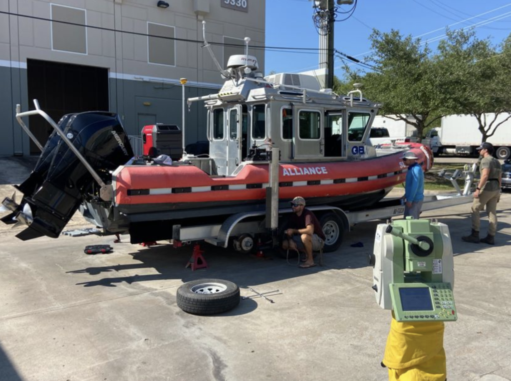
When commissioning of a new hydrographic survey vessels or changing/installing additional sensors it is vital to verify the exact position of each of these instruments relative to the vessel’s coordinate system based on the hull. Centerline of the vessel is established in dry dock from the keel or quayside from the wheelhouse or mast and the center stern. The Z plane is measured with points around the deck. All offsets are then relative to this coordinate system. This will ensure that the survey data collected will be as precise as possible and it greatly reduces the time necessary to complete GAMS and patch testing. DimCon also makes alongside nav checks and sea trials necessary to be completed much quicker to gain vessel acceptance from the client. This helps our customers bottom line by reducing overhead days before they can go on contract.
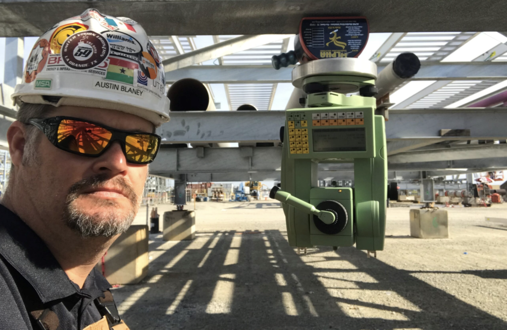
Using high precision 1 arc second Leica total stations with Spatial Analyzer metrology software, it allows us to work on the vessel quayside pitching, rolling and unleveled and still provide 1mm accurate feature offsets/lever arms in the same coordinate system. We use 4 – 6 GPS static control points on the dock to establish a network of grid coordinates that we use to carry out Gyro and DGPS verifications. Heading, Pitch and Roll verifications are completed with two total stations taking simultaneous shots synchronized to GPS UTC time so data can be compared to time stamps from vessel logs. In most instances we are able to provide all C-O corrections before we leave the vessel. Our goal is for the boat to go to work as soon as possible after we complete our scope of work for the DimCon vessel calibration.
Our experience ranges from drill ships all the way down to side scan tow fish. We can assist with all size boats, ROVs, AUVs, USVs, etc., whether quayside or in dry dock.
Paisano Dimensional Control uses precision survey equipment and metrology software to capture and interrogate data. Survey reports are provided to client and crane inspectors for review and we can assist with making adjustments and repairs as needed. We can also provide as-built surveys to record successful adjustments and provide a baseline for future survey reference.
Contact us to discuss details about your Hydrographic Survey DimCon needs.
austin@paisanodc.com
Precision Mapping for Projects That Matter
When you’re planning a project that intersects with water—whether it’s for construction, navigation, environmental protection, or energy development—you need accurate data you can trust. At Paisano Dimensional Control, we offer Hydrographic Survey DimCon services that bring clarity, confidence, and actionable intelligence to your decision-making. Our team isn’t just running a sonar and handing over a chart. We’re in the business of delivering answers, revealing the unseen, and guiding your project with unmatched precision.
We know how much is riding on getting it right. That’s why we take pride in being more than a vendor—we’re your partner in progress.this system in place, the collected data is as accurate as possible, enabling quicker completion of essential tests like GAMS and patch testing.
Why Hydrographic Survey DimCon Is Essential to Your Project
If your project touches water, it touches risk. Shifting seabeds, unpredictable depths, submerged hazards, and regulatory requirements can all create costly delays if not accounted for properly. With our Hydrographic Survey DimCon services, we strip away the unknowns. We deliver detailed bathymetric data and underwater topography so you can plan smarter, execute faster, and stay compliant every step of the way.
We’re not just talking about “good enough” data—we’re committed to exactness. That’s the DimCon promise. From rivers and lakes to coastal zones and offshore sites, we tailor our services to your unique environment and objectives.
Built on Accuracy: What Sets Hydrographic Survey DimCon Apart
There are plenty of ways to collect hydrographic data, but at Paisano Dimensional Control, we believe how it’s interpreted, processed, and applied makes all the difference. With us, you don’t just get a service—you get a solution.
When you hire us for Hydrographic Survey DimCon, we become an extension of your team. We work in real-time, adapt to site conditions, and never lose sight of your end goals. The technology we use is state-of-the-art, sure, but it’s our people who turn that data into insights that actually help you make informed decisions.
We understand the language of the water—its patterns, behavior, and influence on your structure or system. That understanding informs every scan, every chart, and every conversation we have with you. That’s the difference DimCon brings to the table.
Confidence Below the Surface
Water hides things. That’s its nature. But with Hydrographic Survey DimCon, we give you the confidence to move forward as if everything was laid out in the open. When we perform a survey, we’re uncovering layers of information that protect your investment, your people, and your timeline.
It’s about more than just maps. It’s about control—control over variables, control over outcomes, and control over your budget. We’ve helped clients across industries gain a clearer picture of what’s beneath them, whether it’s to place a pipeline, anchor a dock, inspect dredging impact, or establish a construction corridor.
We Work Where Others Hesitate
Some survey teams shy away from challenging conditions. Not us. Our team is built for complexity. In fact, we thrive in it. Whether it’s shallow water, tidal interference, or areas with heavy vessel traffic, our Hydrographic Survey DimCon approach is designed to meet the moment.
From freshwater reservoirs to turbulent marine zones, we apply our decades of experience to assess every challenge head-on. We don’t believe in cookie-cutter solutions. We believe in craftsmanship, attention to detail, and taking the time to understand what success looks like for you.
That’s the Paisano way—and it shows in our results.
Supporting Every Phase of Your Project
From pre-construction to post-project validation, Hydrographic Survey DimCon plays a vital role in each phase. We support feasibility studies, environmental assessments, permitting, construction layout, and post-installation monitoring.
If you’re planning to build in or near water, our surveys ensure you’re starting from a place of knowledge, not guesswork. We help you identify risks early, optimize resource allocation, and validate progress along the way. And when regulators come calling? You’ll have the data to back every decision.
Relationships Matter—And So Does Communication
We believe in keeping things personal and professional. When you reach out to Paisano Dimensional Control, you’re not getting passed from person to person. You’ll have direct contact with our experienced team, fast answers to your questions, and a transparent process from start to finish.
Hydrographic surveys can be complex, but we take the time to make sure you understand what we’re doing and why it matters to your specific goals. That’s part of what makes Hydrographic Survey DimCon different—we don’t just send you a report, we talk you through it. We’re with you every step of the way.
Trusted by Industry Leaders
We’ve earned the trust of clients across energy, civil engineering, maritime logistics, and environmental sectors. Why? Because Hydrographic Survey DimCon consistently delivers accurate data that holds up under scrutiny and supports real-world decision-making.
We’ve been brought in to rescue projects that were veering off track. We’ve saved clients thousands—sometimes millions—by detecting inconsistencies or potential hazards before they became a problem. We’re not saying that to brag. We’re saying it because that’s what’s possible when you invest in a team that actually cares about your outcome.
When Every Inch Counts, Count on Us
Precision is our obsession. We know that an inch of miscalculation can turn into a mile of problems. That’s why our Hydrographic Survey DimCon services are built around tight tolerances and rigorous standards. We calibrate constantly. We double-check our work. And we don’t rest until we know you have exactly what you need.
If you’re tired of generic results or teams that show up with a one-size-fits-all approach, you’re going to feel right at home with us. We care about quality because we care about the people we serve—and we want you to win.
We’re Not Here to Sell. We’re Here to Solve.
At Paisano Dimensional Control, our job isn’t to upsell you. Our job is to equip you with the information you need to make smart, forward-thinking decisions. That’s what Hydrographic Survey DimCon is all about. We’re not here to impress you with tech talk—we’re here to help you move forward confidently, with clarity and precision.
We listen. We ask smart questions. We show up prepared. And we stand by our work.
A Real Team You Can Count On
We’ve built a culture of integrity, discipline, and customer-first thinking. We don’t cut corners. We don’t make promises we can’t keep. And we’re always honest with you—especially when it matters most. That’s the foundation of every Hydrographic Survey DimCon engagement we take on.
You deserve a team that brings not only skills but also heart to the work. That’s us. We’re proud of our technical capabilities, but we’re just as proud of the relationships we’ve built and the trust we’ve earned.
Why Clients Choose Paisano Dimensional Control
- Custom-tailored solutions: We adapt our surveys to your project’s exact needs.
- Unmatched accuracy: Our measurements are precise, reliable, and verifiable.
- Experienced field crews: We’ve worked in every kind of environment—nothing surprises us.
- Responsive communication: You’re never left wondering where things stand.
- End-to-end support: We stay involved until the job is truly done.
When you work with us, you’re not just buying a service. You’re buying peace of mind.
Why Hydrographic Survey DimCon Is the Smart Choice
The underwater world doesn’t have to be a mystery. With Hydrographic Survey DimCon, we reveal what others miss. We bring clarity, accuracy, and confidence to your project—whether you’re building, repairing, or maintaining assets that intersect with water.
And the team at Paisano Dimensional Control is ready to stand beside you every step of the way.
We know how much this work matters. And we’re proud to be the partner you can count on when precision isn’t optional—it’s critical.
Let’s get started.